Satellite Imagery for Natural Resources
Satellite imagery and GIS maps (Geographic Information Systems) can play an important role for natural resources including agriculture, forestry, and coastal management for assessment and analysis.
Satellite images can provide spatial resolutions of up to 30-centimeters for better analysis, assessment, and monitoring of our natural resources. This technology can contribute to a wide array of global change-related application areas for vegetation and ecosystem dynamics, hazard, and disaster monitoring, geological and soil analysis, land surface climatology, hydrology, land cover change, and the generation of orthorectified Digital Elevation Models (DEMs).

Utilizing high-resolution, multispectral satellite or aerial imagery and Artificial Intelligence (AI), Machine Learning (ML), and Computer Vision (CV) algorithms, image data is collected and transferred into management solutions for crop health and improved production targets.
Xinavane – Mozambique Sugar Cane Plantation
Satellite Imagery 4-Band (RGBN) Spectral Image Data – KMZ
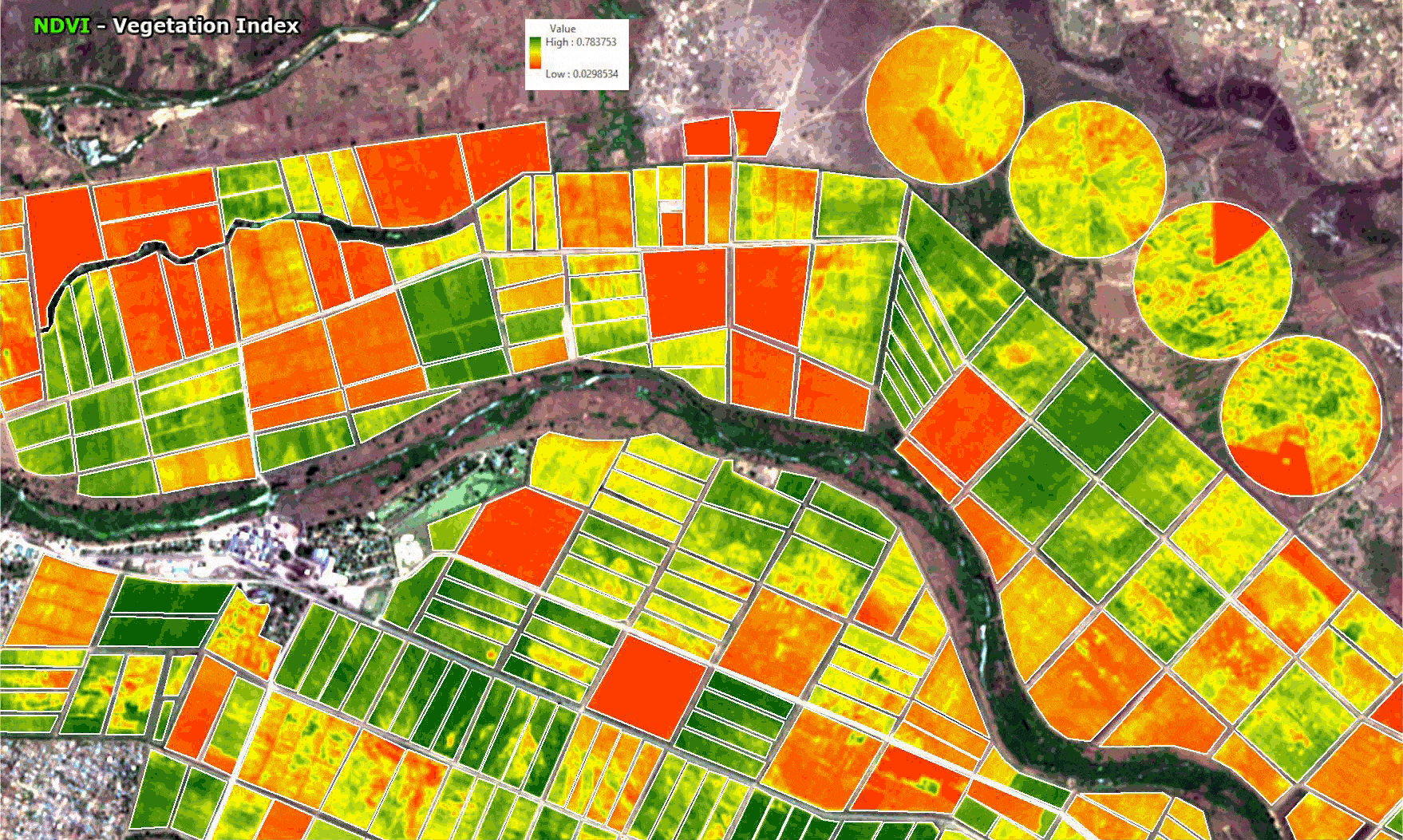
Normalized Difference Vegetation Index (NDVI) Scale Used
Background Image: Google Earth – © Google
Click image to view animation


