Vegetation and Water Indices
Making better decisions faster
With the weather, environmental, and production variables to consider, the only thing growers can count on is uncertainty. Having up-to-date, comprehensive information from each field is crucial to optimizing your crop management strategies throughout the season.
Central to the agriculture product line, green vegetation index maps are detailed images that give growers an absolute measure of the amount of green vegetation present in their fields. These maps show the integrated result of inputs and environmental, physical, and cultural factors affecting your crop. With the vegetation and water indices we provide, you can routinely and quantitatively assess vegetation amount, status and variation across your land, from bare soil to a dense canopy, to better manage your crops and monitor for any waterlogging problems and work backward in time to identify yield-limiting factors.
Xinavane – Mozambique Sugar Cane Plantation
Satellite Imagery 3m 8-Band VNIR Spectral Image Data – KMZ
Click image to view animation
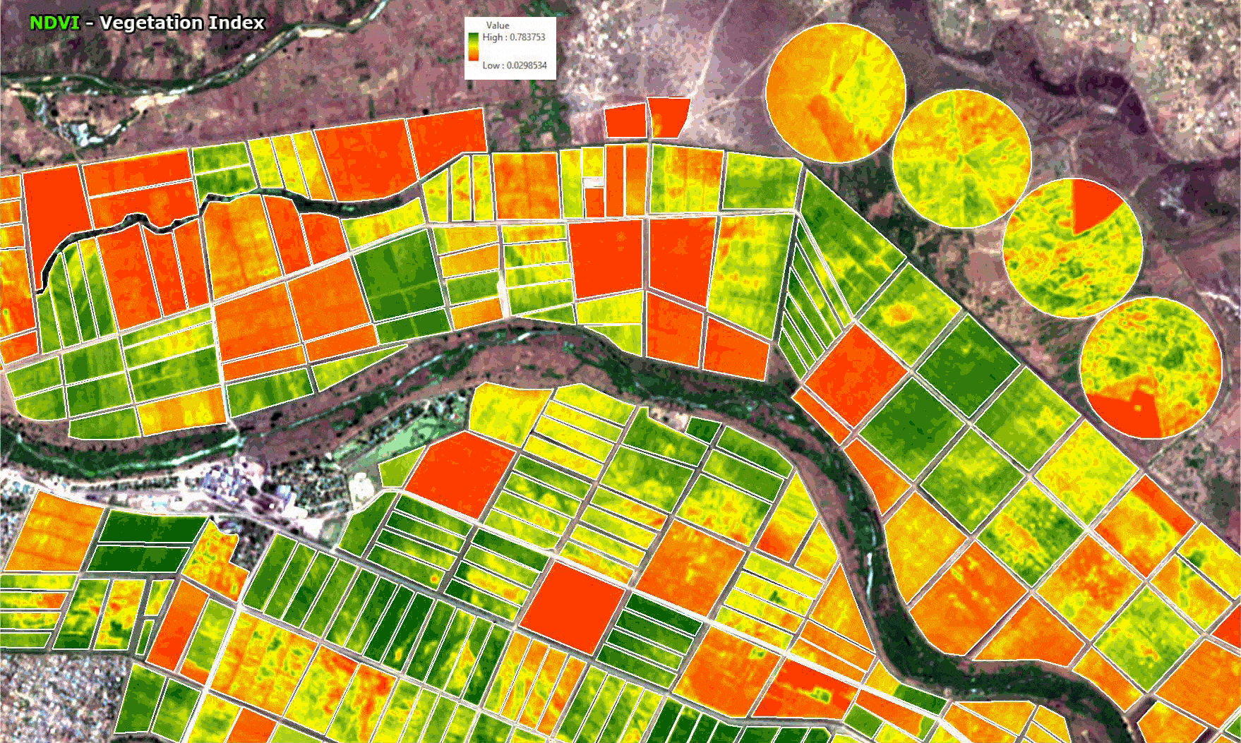
Background Image: Google Earth – © Google
Capturing overviews of large production areas, green vegetation maps shows trends across multiple farms. To enhance your in-season decisions the imagery program collects data predefined times and delivers those data, through an assigned API online in near real-time. Green vegetation maps are a significant revenue-enhancing tool that shows you were to scout and sample, the extent and severity of problem areas and where to apply inputs, crop protection products, growth regulators, defoliants and water use.
View article on Agriculture Crop Management and Production Improved by Satellite Remote Sensing Technology and Geographic Information Systems (GIS)
A standardized measure of the state of affairs
The vegetation and water indices provided gives you a complete and accurate picture of vegetation amount and variability without errors caused by soil and moisture. To create a green vegetation index map utilizing high-resolution satellite images collected by and calibrated using your crops and special developed spectral algorithms are applied to separate the reflectance of vegetation from variation caused by underlying soils or water.
Offering a crystal-clear picture of the current state of your crops, the green vegetation index is a repeatable measure that can be applied consistently across various scenes, sample locations, and time intervals. Growers, consultants, and scientists can easily correlate the green vegetation index to industry-standard vegetation measures, such as Green Leaf Area Index, biomass, or percent canopy cover.
The end result is quantifiable data showing the vegetative status of each field that you can use to quickly and accurately identify local, regional or worldwide trends. Since the maps are calibrated they can be used to generate application maps in either desktop GIS packages or through online solutions provided through Satellite Imaging Corporation.
Seeing where you cannot walk
The vegetation and water indices are unique in its ability to help users spot potential problems in dense, nonwalkable crops. Other indices cannot measure vegetative differences once the crop canopy covers the ground. With vegetation and water indices you can see what is going on in areas you can’t access. With the help of digital maps like Google Earth™, growers, managers, advisors, and consultants are making critical farming decisions faster, improving crop quality, and increasing productivity.
For more information on our products and services or for a consultation, please contact us.


