Remote Sensing for Tourism and Leisure
The tourism and leisure industries currently use high-resolution satellite imagery, global positioning system (GPS), and geographic information system GIS data for presentation and proposal strategies that will maximize the promotional appeal of tourism and its main assets.
The combination of Digital Elevation Models (DEMs) with high-resolution satellite imagery is the basis for the development of 3D maps, virtual flights, and panoramas. The use of this technolgy allows tourists and visitors to explore their favorite tourist destinations in a safe manner with excepetional navigation and tracking information at their finger tips. Travelers can retrieve weather data, trip planning, destination information, hiking and biking maps, and tourist attractions.
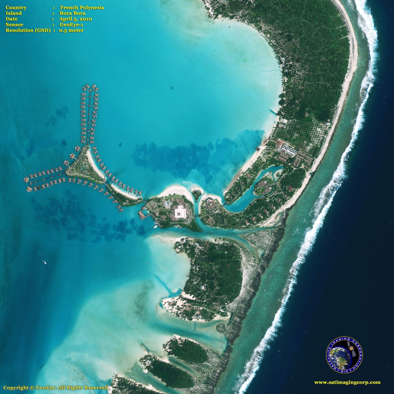
GeoEye-1 (0.5m) Satellite Image of Bora Bora, French Polynesia
Copyright © MAXAR. All rights reserved.
The demand for accurate 3D digital maps is perhaps more important than ever for agencies and owners. SIC’s professional team can provide end-to-end custom solutions that meet our client’s needs.


