Privacy Policy
Thank you for placing your trust in Satellite Imaging Corporation. We are committed to protecting your personal data.
This privacy policy has been compiled to better serve those who are concerned with how their Personally Identifiable Information (PII) is being used online. PII is information that can be used on its own or with other information to identify, contact, or locate a single person, or to identify an individual in context.
Please read our privacy policy carefully to understand how we collect, use, and handle your Personally Identifiable Information.
Information We Collect
When inquiring about our services or registering on our site, you may be asked to enter your name, e-mail address, mailing address, phone number, or other details that are necessary to conduct business or provide a personalized experience.
We collect personal information from you when you use our contact form to inquire about our services, register a personal account, place an order, or subscribe to a newsletter.
Usage of Personal Informationd
Your personal information is used to:
- Personalize your experience by delivering content and product information that we believe will interest you.
- Contact you and follow up on project inquiries.
- Send periodic e-mails regarding your account, order(s), or other products and services.
Handling of Sensitive Information
Our website is scanned on a regular basis for known security vulnerabilities in order to make your visit to our site as safe as possible.
Your personal information may only be accessed by a limited number of people with special access rights to our corporate systems, and are required to keep any personal information confidential.
Any credit card transactions are processed using a secure gateway. No credit card information is stored on or passed through our web servers.
Cookies and Cookie Opt-Outa
Cookies contain small amounts of data that may persist between site visits and allow us to identify a unique web browser. We use cookies to personalize your experience, provide login capabilities, and conduct anonymous web analytics. In addition, our third-party ad partners use cookies to serve online advertisements to you and other visitors.
You can choose to have your computer warn you each time a cookie is being sent, or you can choose to turn off all cookies. Please refer to the documentation provided with your web browser for further instructions about how to manage and disable cookies. Because certain site features depend upon cookies, disabling them may result in a degraded experience.
Third-Party Links
We may occasionally link to resources that are hosted on external websites. Satellite Imaging Corporation has no control over the privacy policies or practices of these other sites and is not responsible for the privacy practices or the content of websites to which we link, list, rank, or identify by means of a search.
Satellite Imaging Corporation takes no responsibility for the products, services, policies or actions of third-parties, or the content of third party websites. We encourage you to be aware when you are leaving our site and to read the privacy policies of each website you visit.
Third-Party Disclosured
We do not sell, trade, or otherwise transfer to outside parties your personally identifiable information unless we provide you with advance notice. This does not include website hosting partners and other parties who assist us in operating our website, conducting our business, or servicing you, so long as those parties agree to keep this information confidential. We may also release your information when we believe release is appropriate to comply with the law, enforce our site policies, or protect our or others rights, property, or safety.
At our discretion, non-personally-identifying visitor information may be provided to third parties for marketing, advertising, or other purposes.
We use Google Analytics to conduct anonymous web analytics. Please refer to the Google Analytics privacy policy for more information.d
AdRoll
Our display advertising partner, AdRoll, enables us to present you with retargeting advertising on other sites based on your previous interaction with Satellite Imaging Corporation. The techniques our partners employ do not collect personal information, such as your name, e-mail address, postal address, or telephone number. You can visit this page to-opt out of AdRoll’s and their partners’ targeted advertising.
Do Not Track
We do not currently acknowledge or take action based on Do Not Track headers.d
Children and COPPAd
We do not knowingly collect any information from children under 13 years of age.
Data Breach Notifications
Should we become aware of a data breach, we will make reasonable efforts to notify affected users via e-mail within 7 business days. In addition, we will post a notification on our site.
E-Mail Opt-Out
We use your e-mail address to:
- Send information, respond to inquiries, and/or other requests or questions
- Process orders and send information and updates pertaining to orders
- Provide additional information related to your product and/or service
- Market to our mailing list subscribers
- Stay in contact with our clients following their original transactions with us
If you would like to remove yourself from our mailing list, please e-mail us at info@satimagingcorp.com, and we will promptly remove you.
Contact Information
If you have concerns or questions about our privacy policy or would like to correct or access any of your personal information, please use the following information to contact us.
Satellite Imaging Corporation
Email: info@satimagingcorp.com
Phone: (1) 832-761-7865 Ext.: 203
Changes
At our discretion, we may periodically update this privacy policy. When an update occurs, a revision notice will be posted on this page.
Last Revised: November 6, 2021

Satellite Sensor
IMAGING Corporation Satellite Sensors
(0.50m)
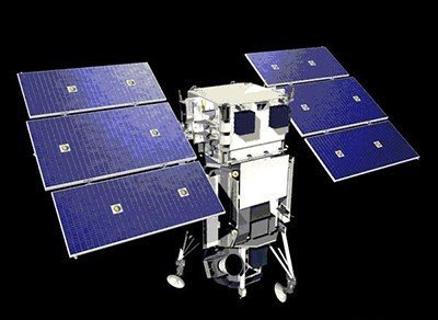
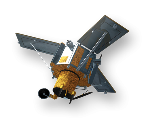
WorldView-1 satellite sensor was successfully launched from Vandenberg Air Force Base, California, U.S.A., at 11:35 Hrs Pacific Daylight Time (PDT) on September 18th, 2007. Watch video of WorldView-1 satellite launch. The WorldView-1 offers a high-capacity, panchromatic imaging system which features 0.50m resolution imagery.
(0.50m)
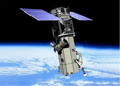
VANTOR’s WorldView-2 satellite sensor, launched October 8, 2009, provides 0.46m panchromatic (B&W) mono and stereo satellite image data.
The WorldView-2 sensor provides a high-resolution panchromatic band and eight (8) multispectral bands; four (4) standard colors (red, green, blue, and near-infrared 1) and four (4) new bands (coastal, yellow, red edge, and near-infrared 2), full-color images for enhanced spectral analysis, mineral mapping, wildlife monitoring, land-use planning, disaster relief, defense, and climate change.
(0.50m)
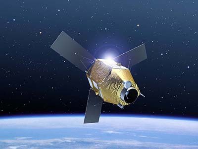
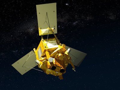
AIRBUS Defence & Space Pleiades-1A satellite sensor was successfully launched on December 16, 2011, and provides 0.5m high resolution satellite image data. Watch video of Pleiades-1A satellite launch.
The Pleiades-1A satellite is capable of providing orthorectified color data at 0.5-meter resolution (roughly comparable to GeoEye-1) and revisiting any point on Earth as it covers a total of 1 million square kilometers (approximately 386,102 square miles) daily. Perhaps most importantly, Pleiades-1A is capable of acquiring high-resolution stereo imagery in just one pass and can accommodate large areas (up to 1,000 km x 1,000 km).
(0.65m) - Decommissioned
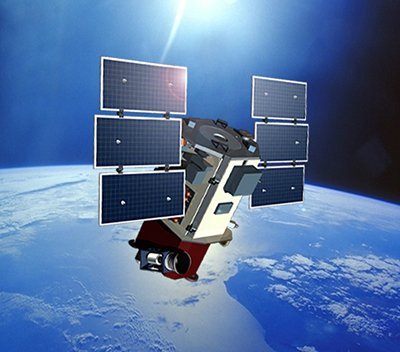
VANTOR’s QuickBird satellite sensor was successfully launched on October 18, 2001, at Vandenberg Air Force Base, California, USA.
Using a state-of-the-art BGIS 2000 sensor (PDF), QuickBird satellite collected image data to 0.65m pixel resolution degree of detail. This satellite was an excellent source of environmental data useful for analyses of changes in land usage, agriculture, and forest climates. QuickBird’s imaging capabilities had applied to a host of industries, including oil and gas exploration and production (E&P), engineering and construction and environmental studies.
(0.80m) - Decommissioned
The IKONOS satellite sensor was successfully launched as the first commercially available high-resolution satellite sensor on September 24, 1999, at Vandenberg Air Force Base, California, USA. The IKONOS satellite sensor was decommissioned by DigitalGlobe on March 31, 2015.

(2.5m/5m) - Decommissioned
The SPOT-5 satellite sensor has been decommissioned as of March 31, 2015. SPOT-5 was successfully placed into orbit by an Ariane 4 from the Guiana Space Centre in Kourou during the night of 3 to 4 May 2002. Archived SPOT-5 Satellite Imagery will remain available.
(1.5m)
SPOT-6 satellite sensor built by AIRBUS Defence & Space was successfully launched on September 9, 2012, by a PSLV launcher from the Satish Dhawan Space Center in India. Watch video of SPOT-6 the satellite launch.
(5m)
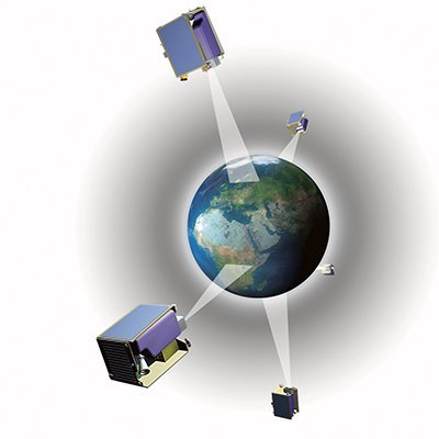
The five (5) RapidEye satellite sensors were successfully launched from the DNEPR-1 Rocket on August 29th, 2008, at Baikonur Cosmodrome in Kazakhstan. RapidEye was built by MacDonald Dettwiler, Ltd. (MDA) and will offer customers a data source containing an unrivaled combination of large-area coverage, frequent revisit intervals, high-resolution, and multispectral capabilities.
After 12 years of operation, Planet decommissioned the RapidEye EO satellite constellation in April 2020.
(15m)
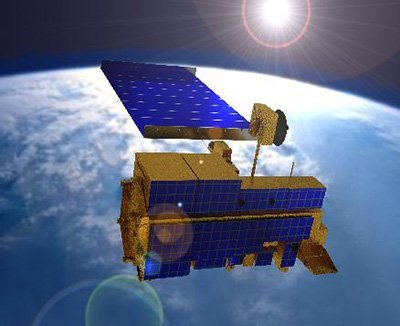
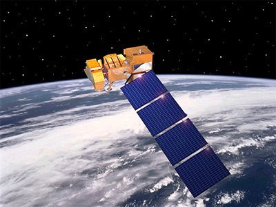
ASTER satellite sensor is one of the five state-of-the-art instrument sensor systems on-board the Terra satellite that was launched on December 18, 1999, at Vandenberg Air Force Base, California, USA.
ASTER is a 15-meter, 14 band multispectral resolution instrument. It can be used for land cover and change detection, calibration, validation, and land surface studies.
(15m)
The Landsat 7 ETM+ satellite sensor was successfully launched from the Vandenburg Air Force Base on April 15, 1999. Landsat 7 satellite is equipped with Enhanced Thematic Mapper Plus (ETM+), the successor of TM. The observation bands are essentially the same seven bands as TM, and the newly added panchromatic band 8, with a high resolution of 15-meters was added. An instrument malfunction occurred on May 31, 2003, with the result that all Landsat 7 scenes acquired since July 14, 2003, have been collected in “SLC-off” mode.
(0.5m)
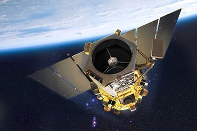
The GeoEye-1 satellite sensor was successfully launched on September 6, 2008. The satellite, which was launched at Vanderberg Air Force Base, California, provides a resolution of 0.46-meters. Watch a video of GeoEye-1 satellite launch. GeoEye-1 is capable of acquiring image data at 0.50-meter panchromatic (B&W) and 1.84-meter multispectral resolution. It also features a revisit time of fewer than three days, as well as the ability to locate an object within just three meters of its physical location.
Ready to get started?
Contact us for a custom imagery solution or request a quote
TESTIMONIALS
Stories & Experiences
Lorem ipsum dolor sit amet, consectetur adipiscing elit, sed do eiusmod tempor incididunt ut labore et dolore magna aliqua. Ut enim ad minim veniam, quis nostrud exercitation. .

Sarah Jones
Lorem ipsum dolor sit amet, consectetur adipiscing elit, sed do eiusmod tempor incididunt ut labore et dolore magna aliqua.

George Tarburton Jr.
Lorem ipsum dolor sit amet, consectetur adipiscing elit, sed do eiusmod tempor incididunt ut labore et dolore magna aliqua. Lorem ipsum dolor sit am

Jason Boothe
Lorem ipsum dolor sit amet, consectetur adipiscing elit, sed do eiusmod tempor incididunt ut labore et dolore magna aliqua.